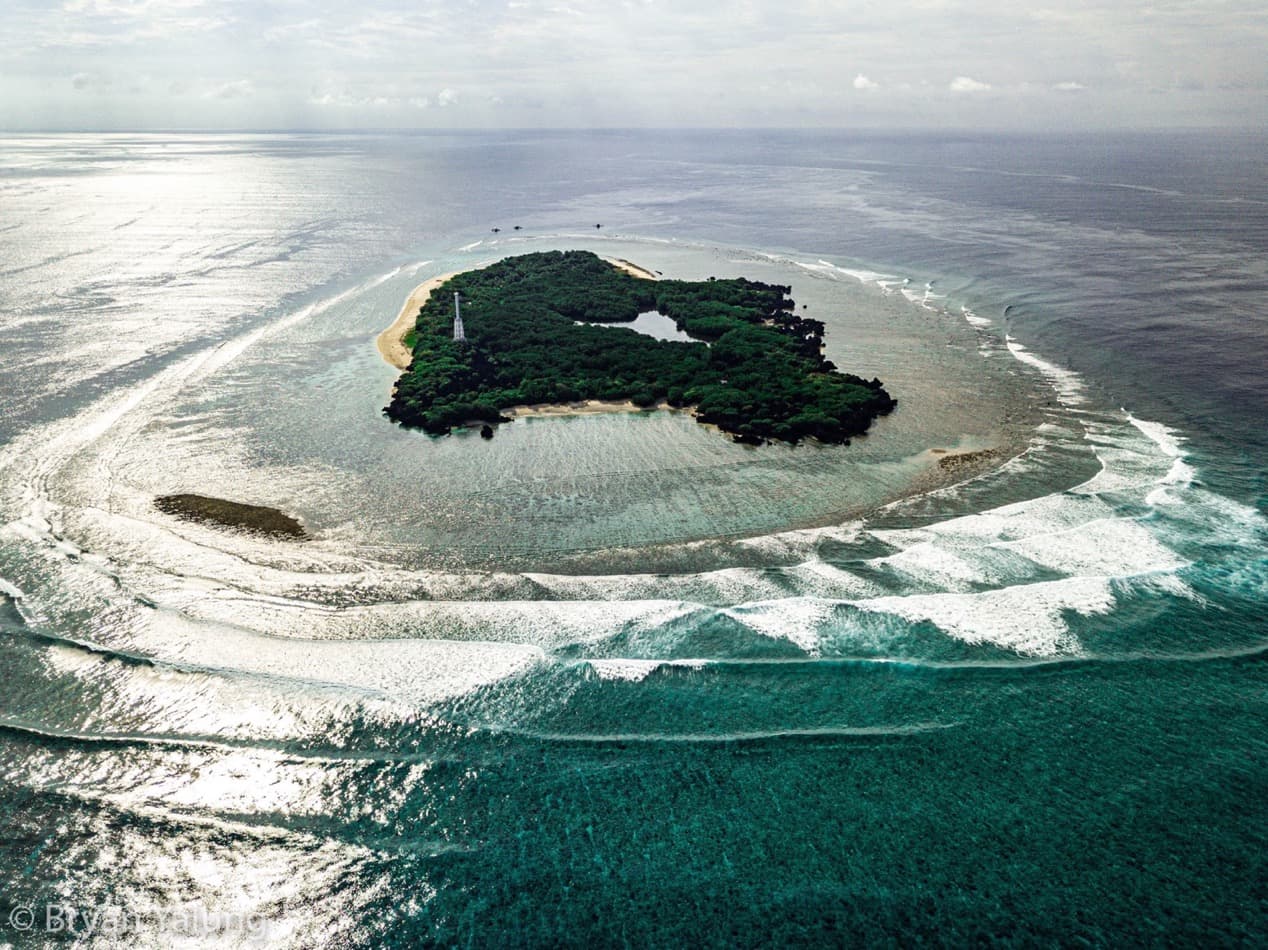
About Apo reef

APO REEF NATURAL PARK

Apo Reef can be found around 15 nautical miles (28 km; 17 mi) west of the nearest coast of the Philippines, Municipality of Sablayan, in the Island of Mindoro. Apo Reef is roughly a triangular coral atoll formation approximately 26 kilometers (16 mi) from the north to the south tip, and 20 kilometers (12 mi) from east to west. It is separated by two lagoon systems, the north and south lagoons which are bounded by narrow reef platforms. It is a 34 square kilometers (13 sq mi) almost triangular northern and southern atoll-like reefs separated by a deep channel that is open to the west.

It has three main islands, namely, Apo Island, Apo Menor (Binanggaan Island), and Cayos del Bajo (Tinankapan) (Figure 1). Apo Island has a total area of 22.67 hectares and is the largest of the three islands, wherein a lighthouse constructed during the Spanish colonial period is located. Apo Menor, also known as Binangaan Island, covers a total of 2.63 hectares and is a rocky limestone island with few vegetation composed of mangrove and beach tree species. Cayos del Bajo is the smallest island which has a total area of 0.28 hectares and is composed of flat coralline rock formation with no vegetation.

ARNP Lagoons​

The ARNP lagoons are bounded by narrow reef platforms. The sand bottom depth between corals of North Lagoon is 1 to 3 fathoms and the southern part is boat passage open to the channel by discontinuous mounds of coral growth. The south lagoon is deeper with multi-level sand bottom and isolated coral patches from 1/4 to 14 fathoms deep. A narrow channel opens to the southeast side of the reef that declines gradually from 1-45 fathoms extending to the boundary line of the ARNP. A channel with a depth of 5-27 fathoms and measuring approximately 6 nautical miles long and 1 nautical mile wide separates the two lagoons. The channel is open to the West while the eastern side of the channel has numerous coral heads. It is characterized by reef walls, drop- offs, reef flats, islands, shorelines, tidal pools, and rocky intertidal areas.

The north lagoon is an enclosed triangular coral reef platform partly exposed during low tide. It is relatively shallow with depths of about 2-10 m. Coral mounds proliferate the sandy substrate of the lagoon especially at the southeast end. The south lagoon is an inverted triangular coral platform enclosed on two sides and is about 30 m in depth. Marking the west point where the two platforms meet is Apo Menor Island, a low coralline and mangrove islet. The southeast portion of the south lagoon is an “open back reef” which is sloping and has depths of 10–20 m. Steep-sided coral mounds with shallow flattop and bases with a diameter of 20-25 m proliferate here.

Land Ownership, and Rights and Privileges

ARNP is owned by the state. It is under the management of the DENR thru the enactment of RA 11038 also known as the Expanded National Integrated Protected Areas System (E-NIPAS) Act of 2018. Geographically, it is under the jurisdiction of the Municipality of Sablayan, in Occidental Mindoro. There are no inhabitants in ARNP. In 2007, it was declared as no-take zone by the PAMB where all fishing and fishing-related activities were prohibited. Today, ecotourism activities in the multiple use zone are allowed. Researches are also being conducted upon approval by the PAMB.

Bathymetric map generated from multibeam echosounder survey in Apo

APO REEF NATURAL PARK

Geology/ Geomorphology

The University of the Philippines Diliman Marine Science Institute has mapped the seafloor of Apo Reef Natural Park using acoustic surveys (side-sonar scanner and multibeam echosounder). A drop camera survey was done to see the real-time images of the seafloor. Environmental factors and oceanographic data were also gathered. It was observed that the east, west, and northwest sides of Apo Island have a range of depth from less than 5 m to around 35 m. Furthermore, inside the channel reached a depth up to 45 m, with the opening near Binanggaan reaching up to 55-80 m deep. Likewise, these are supported by the habitat mapping done by Bacabac et al. (2023) as shown in Figure 3. The area on the edge of the channel was surrounded with mixed live coral and dead corals with algae. A ground survey was also done to determine the classifications. This seafloor feature (reef mounds) provides substrates suitable for coral colonization.

Hydrology

Tide flow was also measured by Siringan et al. (2015) as well as environmental factors particularly temperature and salinity. An Acoustic Doppler Current Profiler (ADCP) was used to check the surface current velocity during the period of 26-29 May 2015 (Figure 4). A non-tidal dominant forcing was suggested by the northwest-moving surface current around Apo Island and the west opening of Apo Reef channel during distinct tide phases. 0.5 cm s−1 was the mean observed current.

During the survey period, it was observed that the water column during ebb tide flow in the upper portion of the channel opening was moving predominantly to the west, similar to the upper 15 m of the lower portion of the channel. No data was obtained in the passage towards Apo Island as it was beyond the limit of ADCP 600 kHz. However, at the Apo Island, it was observed that the current was moving northwest and southwest.

Current velocities and bathymetry within the surveyed area of Apo Island and Apo Reef, Mindoro.

Soils

Soil classification and chemical analysis has not yet been conducted for ARNP even by the Bureau of Soils. The area is dominantly underlain by reef limestone and coralline sand on the east and southeastern sides. Outside the lagoonal mangroves in the eastern and southern sides of Apo Island, the soil falls into sandy to sandy-loam that is less in silt and clay particles. This type of soil has low water holding capacity, infiltration and permeability. On the other hand, the lagoonal mangroves have a sandy loam to clay loam soil, underlain by decomposed plant residues or coarse materials.

climate

ARNP falls under the Type I climate according to the modified Corona’s classification. It is characterized by two pronounced seasons – dry from November to April and wet during the rest of the year. Maximum rain period is from June to September (PAG-ASA, 2010).